TOURING HISTORIC ROUTE 1 AND EXPLORING
400 YEARS IN BERMUDA OF CHESTERFIELD COUNTY
When English settlers planted their first permanent colony in Virginia in 1607, the Appomatucks of Chief Powhatan’s confederation had long called home, the present day Bermuda District of Chesterfield County, Virginia. The James River and Appomattox River join at the far eastern point of the county. The James River formed the eastern and northern boundaries of Chesterfield County (officially formed in 1749) and the Appomattox River formed the southern boundary of the county. Several of Virginia’s largest settlements, Richmond and Petersburg, developed on the opposite banks from the county at the fall line or westbound navigable limits on both rivers.
During the 1600’s and 1700’s paths and later horse and wagon trails developed along the west bank of the James River to connect Richmond to the north and Petersburg to the south. During the 1820’s a gravel road was built between the localities. In the 1800’s a railroad paralleled the travel road. By the 1900’s, highways and a streetcar line were constructed in the Bermuda District. At the annual convention in 1913, the United Daughters of the Confederacy (UDC) passed a resolution to promote the creation of a road as a memorial to the president of the Confederacy to be called the Jefferson Davis Highway (JDH) connecting many southern capitals from Washington, DC to California and north along the Pacific coastline. This was in response to the Lincoln Highway being built across the northern United States. JDH, U.S. Routes 1 and 301 (all the same highway) and Interstate 95, today join Richmond and Petersburg; all streetcars were discontinued by 1949.
Also during the 20th century, settlement and growth resulted in Chesterfield County losing land area along the JDH. Manchester to the north was twice annexed by the City of Richmond in 1910 and in 1942 and Colonial Heights to the south became an independent city in 1948. Bermuda’s strategic geographical position of waterways and transportation arteries, has led to abundant industrial and suburban growth for well over a century.
An Overview of 400 Years of Chesterfield History:
1600’s -- Settlement and Early Colonial Era
1700’s -- Colonial, Revolutionary War, New Nation Era
1800’s -- Developing Nation, Civil War, Reconstruction Era
1900’s -- Industrial and Suburban Era
Today there are many sites one may tour along the JDH to relive the bygone eras and to experience the advantages of modern day living along Historic Route 1 in Chesterfield.
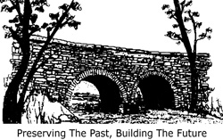
Henricus Historical Park (1611) -- Henricus Historical Park (1611) -- an English settlement exhibit, including Falling Creek Wayside, ruins of the Old Stone Bridge and UDC Marker. JDH @ Osborne Rd. 804.706.1340.
Half Way House (1760) -- Tavern and present day restaurant, 10301 JDH, one mile north of the Route 288 Interchange. 804.275.1760.
Swift Creek Mill Theatre (1850’s) -- Grist and flour mill, presently houses live dinner theatre performances, 17401 JDH at Swift Creek, Colonial Heights.
Drewry’s Bluff or Fort Darling (1862) -- Civil War battle site, home of the Confederate Naval Academy, a Richmond National Battlefields Park, JDH @ Bellwood Rd. 804.771.2145.
Chester Village -- 19th and 20th century village with modern shopping and services, JDH @ East and West on Route 10.
Bellwood Drive-In Flea Market -- former drive-in theatre used today as a gigantic outdoor shopping area , open Sat. and Sun. JDH @ Willis Rd. 804.275.1187.
|
